Moscow Airports Map
On this page, you will find the maps of Domodedovo, Sheremetyevo and Vnukovo airports. Moscow is served by four airports, Sheremetyevo, Vnukovo, Domodedovo and Zhukovsky, which together handled about 76.9 million passengers in 2024.
Domodedovo International Airport & Terminal Map (DME)
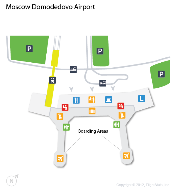
Domodedovo terminal map
Domodedovo International Airport handled 15.6 million passengers in 2024, making it Russia's fourth-busiest airport. All flights use a single passenger terminal building. To reach the city center, the best options are the Aeroexpress train to Paveletsky station, the suburban trains of the Paveletsky line (Павелецкое направление) or a taxi.
Sheremetyevo International Airport & Terminal Map (SVO)
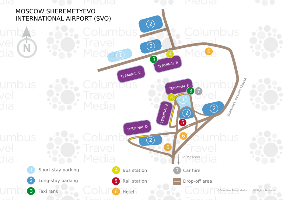
Sheremetyevo terminal map
Sheremetyevo International Airport is Russia's busiest airport, with 43.7 million passengers in 2024. Its passenger terminals form a northern complex (Terminals B and C) and a southern complex (Terminals D, E and F), linked by an underground people mover. To reach the city center, the best options are the Aeroexpress train to Belorussky station, bus 851 to Rechnoy Vokzal (metro line 2), bus 817 to Planernaya (metro line 7), or a taxi.
Vnukovo International Airport & Terminal Map (VKO)
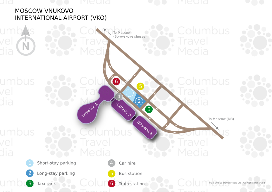
Vnukovo terminal map
Vnukovo International Airport is Russia's third-busiest airport, with 16.1 million passengers in 2024. Its main passenger complex, Vnukovo-1, comprises Terminals A, B and D, with most flights now using Terminal A. To reach the city center, the best options are metro line 8A (Solntsevskaya), whose Aeroport Vnukovo station opened in 2023, the suburban trains from Kievsky station (Киевское направление), which replaced the Aeroexpress in 2024, or a taxi.